A full TAK client lives inside the same 3D scene as your radar tracks, imagery, and terrain analysis. Reach a TAK Server over STOMP mTLS-wss, or drop to UDP multicast on a disconnected LAN - blue-force overlay, GeoChat, missions, and alerts either way. When the network is gone entirely, mission data packages move the picture by hand.
Watch the full ~4.5-minute operational walkthrough: connecting to TAK Server over STOMP mTLS, streaming live blue-force tracks over 3D terrain, tactical GeoChat messaging, geofence enter/exit alert triggers, Mission Board kanban tasking, collaborative scheme of maneuver sketches, and after-action timeline replay.
Most TAK integrations assume a server. 3D Map Explorer speaks both dialects: STOMP over mutually-authenticated TLS WebSockets to a TAK Server, and plain UDP multicast for air-gapped enclaves where no server exists at all.
.zip with manifest.xml + contents/cot.xml for disconnected sharing.// two ways onto the tactical net > connect stomp mTLS-wss → TAK Server > connect udp-multicast → air-gapped LAN // disconnected sharing - mission data package mission_package.zip ├─ manifest.xml └─ contents/cot.xml ● blue-force overlay · GeoChat · missions · alerts GEOFENCE ENTER - track crossed alert zone
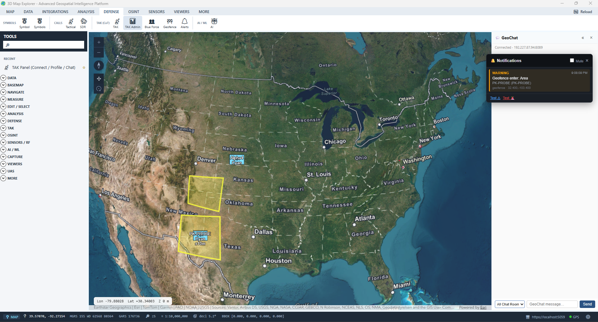
Live geofence alert - GeoChat surfaces a "Geofence enter" warning the instant a blue-force track crosses a defined zone.
The Mission Board turns TAK missions into a working surface: tasks, a shared canvas, and a full after-action replay - all tied to the map.
Kanban-style task management for TAK missions - drag-and-drop task workflow with direct map integration, so a task card and its point on the ground stay linked.
A shared drawing surface with select, sticky, rectangle, ellipse, pen, and pin tools - sketch the scheme of maneuver where the whole team sees it.
Scrub through mission events on a timeline for after-action review - watch the operation unfold again, in order, on the same map.
Administer your TAK Server from inside the COP via the built-in Marti REST proxy dashboard - no separate browser session required.
Export and import missions as standard .zip packages carrying manifest.xml and CoT events - the sneakernet path for disconnected teams.
Define alert zones and get enter/exit alerts as blue-force tracks cross them - perimeter awareness without an operator staring at the screen.
Doctrinally correct symbols and the request formats operators actually transmit - built in, not bolted on.
Alongside TAK, a collaboration layer adds chat, voice, video, PTT, and off-grid mesh - with Cursor-on-Target integration for shared situational awareness.
GeoChat mirrors into a self-hosted Fluxer channel and back - team text chat with file sharing, plus LiveKit-powered voice and video calls with screen share, from the same panel as TAK. Opt-in via Fluxer:Enabled.
Group rooms organized by mission or unit, direct messaging, presence, location sharing, file transfer, and persistent history for after-action review.
Radio-style PTT channels with dispatch integration, emergency alerts, GPS position sharing during transmissions, and compliance recording.
Off-grid team tracking and messaging over a LoRaWAN mesh - geofence monitoring, emergency broadcast, and live positions on the 3D map without internet.
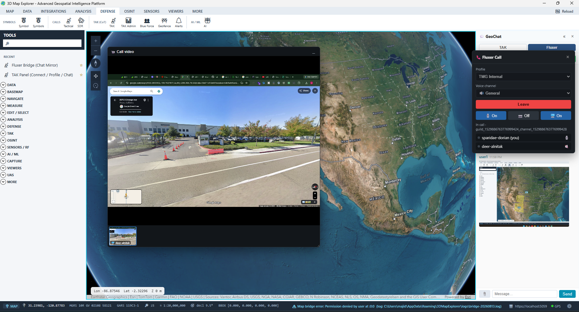
Fluxer voice call with live screen share - right alongside the map.
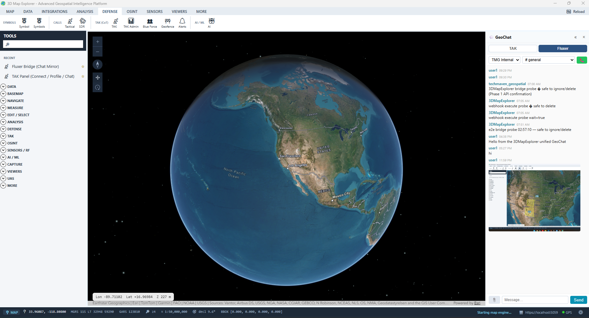
Fluxer text chat with inline file/screenshot sharing, bridged to GeoChat.
The Fluxer bridge is opt-in and requires a self-hosted or TMG-hosted Fluxer instance; voice, video, and screen share run over LiveKit through that same bridge. The XMPP, VoIP, video, PTT, and Meshtastic collaboration services require network connectivity and configured external accounts or hardware; the TAK UDP-multicast path and mission data packages are the air-gapped workflow.
Blue force, radar, imagery, terrain analysis, and mission tasking in one desktop COP - connected to a TAK Server or fully air-gapped on multicast.
